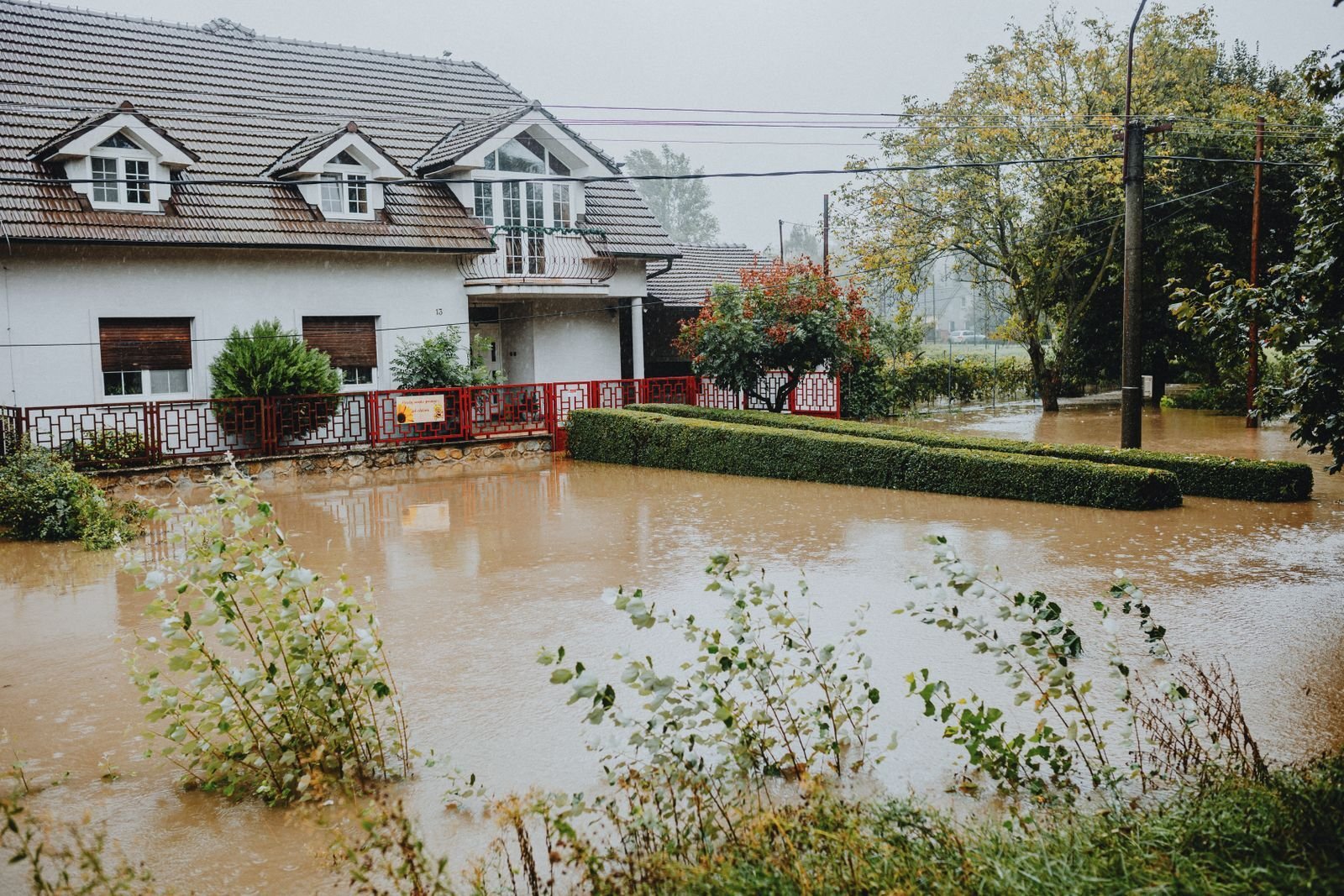
Flash flood risks in Denton County come down to two things: fast, heavy rain and the creeks that carry it. Most flooding here does not come from a big river rising slowly over days. It comes from Pecan Creek, Cooper Creek, Hickory Creek and other small channels that go from a trickle to a torrent in an hour when a storm stalls over the county.
This guide covers where flooding happens, the local events that show what is possible, how to check your own flood zone, why the NFIP 30-day waiting period matters, and exactly what to do before, during and after a flood.
Why Denton County floods so fast
Three local conditions turn heavy rain into flash floods.
Intense spring and fall rain. At DFW, May is the wettest month on average (4.78 inches) and October is second (4.37 inches). Those averages hide the extremes. In May 2015, DFW recorded 16.96 inches, the wettest month on record, and 2015 became the wettest year at 62.61 inches. October 2018 brought 15.66 inches.
Clay soil. Much of the county has clay soils that absorb water slowly and stop absorbing almost completely once saturated. After a few days of rain, nearly every extra inch becomes runoff.
Rapid growth. New rooftops, driveways and streets replace pasture every year. Hard surfaces send water to storm drains and creeks faster than open land did. Cities manage this with detention ponds and drainage rules, but the creeks still rise quickly during a big storm.
The City of Denton notes that floodwater in local creeks can move at 1 to 16 miles per hour and carry several thousand cubic feet of water per second. That is enough to move cars and undercut roads.
The creeks and lakes to know
The City of Denton lists Cooper Creek, Pecan Creek, North Pecan Creek, Hickory Creek, Dry Fork Hickory Creek and their tributaries as the main flood hazard areas inside the city. Across the county, a few more waterways matter.
| Waterway | Where it runs | Where it drains | What to know |
|---|---|---|---|
| Pecan Creek and North Pecan Creek | Through central and east Denton | Out of the city to the southeast | Named by the city as a primary flood hazard area; runs through older, established neighborhoods |
| Cooper Creek | North and northeast Denton | Local creek network; see the city floodplain map | Also a city flood hazard area; the winding streets of the Bell Avenue area follow its course |
| Hickory Creek (and Dry Fork) | Rises in northwest Denton County, skirts Denton Municipal Airport | Runs about 14 miles southeast into Lewisville Lake | Drains roughly 123,000 acres, so a lot of rain funnels into one channel |
| Denton Creek | Starts in Wise County, crosses southwest Denton County | Grapevine Lake | Relevant to the Justin, Northlake and Trophy Club side of the county |
| Little Elm Creek | East side of the county | An arm of Lewisville Lake near Little Elm | Lakefront and low-lying streets can see high water when the lake is up |
| Elm Fork of the Trinity River | From Ray Roberts Lake to Lewisville Lake, then south | Trinity River | Controlled by two Corps of Engineers dams, but releases and backwater still affect low areas |
Ray Roberts Lake and Lewisville Lake
Denton County has two large U.S. Army Corps of Engineers reservoirs on the Elm Fork of the Trinity. Ray Roberts Lake, about 10 miles northeast of Denton between Pilot Point and Sanger, opened in 1986 and covers roughly 29,350 acres. It holds back water upstream of Lewisville Lake, whose dam was completed in 1955. Both lakes were built for flood control and water supply, and Ray Roberts also supplies Denton’s drinking water.
The lakes reduce flooding downstream, but they do not stop creek flash floods. A storm that dumps 4 inches on Denton in two hours floods Pecan Creek long before any of that water reaches a lake. And during very wet years, the lakes themselves rise: after the record rain of May 2015, the Lewisville Lake spillway flowed in June 2015.

Recent flood history in and around Denton
The City of Denton records major flooding in 1996, 2007 and 2015, all driven by heavy rainfall. 2015 is the one most residents remember: record May rain, saturated ground, and creeks out of their banks across the region. October 2018 was another very wet month, with more than 15 inches at DFW.
The city also puts the risk in plain terms: if your home is in the floodplain, there is a 26 percent chance it will flood during the life of a 30-year mortgage. That is far higher than most people guess, and it is the main reason flood insurance makes sense even for homes that have never flooded.
Turn around, don’t drown
Most flood deaths in Texas happen in vehicles. Low water crossings and underpasses can fill in minutes, and it is hard to judge depth at night or in moving water. The National Weather Service and the City of Denton give these numbers:
- 6 inches of moving water can knock an adult off their feet.
- 12 inches of water can float a car or small SUV.
- 18 inches can carry away large vehicles, and 2 feet will carry away most vehicles.
If water covers the road, turn around. The road surface underneath may be washed out, and floodwater hides debris, downed wires and chemicals. Do not let kids play near creeks or drainage channels during or after a storm.
The City of Denton recommends registering with Alert Denton for emergency notifications and keeping a NOAA weather radio at home. A flash flood warning means flooding is happening or about to happen. Move to higher ground right away.
How to check your flood zone
FEMA Flood Insurance Rate Maps show the areas with a 1 percent annual chance of flooding, often called the 100-year floodplain. For Denton, the city lists effective FEMA maps dated April 18, 2011 and June 19, 2020. You can look up your address on the FEMA Flood Map Service Center, or check the city’s interactive map.
A few tips when you read the map:
- Zones starting with A or AE are high-risk flood zones. Lenders require flood insurance there on federally backed mortgages.
- Zone X is moderate to low risk, not no risk. A large share of flood claims nationally come from outside high-risk zones.
- Look at your street, not just your lot. Your house may sit above the flood line while the only road out does not.
- Ask the city. Denton’s floodplain administrator can answer questions about a specific property at (940) 349-8942.
If you are in the floodplain and plan to build or remodel, Denton requires finished floors at least 18 inches of freeboard above the base flood elevation or 30 inches above the 100-year water surface. Check with the city before you start.
Flood insurance and the NFIP 30-day waiting period
Standard homeowners policies do not cover flooding from rising surface water. The City of Denton says this directly, and so does the Texas Department of Insurance. Flood coverage comes from a separate policy through the National Flood Insurance Program or a private carrier, and NFIP coverage is available to all Denton residents.
The catch is timing. An NFIP policy generally has a 30-day waiting period before it takes effect. There are limited exceptions, for example when a lender requires coverage at closing, but for most homeowners you cannot buy a policy when rain is in the forecast and expect it to cover that storm. Since May is the wettest month, buying by early April makes sense.
Two other points worth knowing. Since Risk Rating 2.0 started in April 2022, NFIP premiums are based on each home’s specific flood risk rather than only the map zone. And the Increased Cost of Compliance benefit can pay up to $30,000 toward elevating or otherwise bringing a substantially damaged home up to current floodplain rules.
Our insurance claim coverage estimator shows how coverage typically changes depending on whether you have a flood policy.
What to do after floodwater gets in
Floodwater is Category 3 (black) water under the IICRC S500 standard. It carries soil, sewage, fuel and chemicals. The cleanup rules are stricter than for a pipe leak, and the timeline matters.
- Before re-enteringWait until authorities say it is safe. Do not enter if water is near the electrical panel or outlets. Wear rubber boots and gloves.
- First hour insidePhotograph and video every room, including water lines on the walls. Shut off power to flooded areas if the panel is dry and safe to reach.
- First 24 hoursReport the claim to your flood carrier. Get standing water extracted. Move salvageable items out. Keep kids and pets away from the water.
- Days 1 to 2Remove wet carpet, pad and drywall that touched floodwater, usually with a flood cut 2 feet or more above the water line. Apply antimicrobial.
- Days 2 to 5Structural drying with LGR dehumidifiers and air movers, checked daily with moisture meters until materials reach dry standard.
- After dryingFinal moisture readings, then rebuild: insulation, drywall, baseboards and flooring.
Porous materials that soaked in floodwater, such as carpet pad, insulation and the lower part of drywall, generally cannot be cleaned and saved. The EPA notes that materials dried within 24 to 48 hours usually will not grow mold, which is why extraction and removal should start on day one. Our full guide for homeowners is Flooded Home in Denton? What Homeowners Should Do, and our flood water restoration crews handle extraction, flood cuts, sanitizing and drying.
Not sure how urgent your situation is? The emergency severity calculator asks six quick questions and gives you a priority level with next steps. Homeowners in the city itself can find local details on our Denton water damage restoration page.
Frequently asked questions
Which parts of Denton are most likely to flood?
The city lists the floodplains along Cooper Creek, Pecan Creek, North Pecan Creek, Hickory Creek and Dry Fork Hickory Creek as the main flood hazard areas. Check your address on the FEMA map and ask the city floodplain administrator about a specific property.
Does homeowners insurance cover flash flood damage?
No. Standard homeowners policies exclude rising surface water. You need a separate flood policy through the NFIP or a private carrier. Water from a roof leak or burst pipe during the same storm may be covered under your homeowners policy.
How long does it take for flood insurance to start?
NFIP policies generally take effect after a 30-day waiting period, with limited exceptions such as coverage required by a lender at closing. Private flood policies set their own waiting periods.
Do Ray Roberts and Lewisville lakes protect Denton from flooding?
They reduce river flooding on the Elm Fork of the Trinity, but they do not stop local creek flooding. Creeks like Pecan and Hickory can overflow from a single intense storm before the water reaches either lake.
How much water does it take to sweep a car away?
The National Weather Service says 12 inches of water can float a car or small SUV and 18 inches can carry away large vehicles. Never drive into water covering a road.
Can I clean up floodwater myself?
Small amounts on hard floors can be cleaned with proper gear, but floodwater is Category 3 water. Wet carpet, pad, insulation and drywall usually need to be removed, and hidden moisture needs meters to find. Professional drying lowers the chance of mold.
If floodwater has reached your home anywhere in Denton County, call (940) 274-9880. Our dispatcher answers 24/7, and we aim to have a crew on site in about 60 minutes in most of the county to start extraction and document the damage for your flood claim.